Cool.
Here’s Rainbow Bridge, the world’s largest natural span. Click on the “+” sign twice more to zoom in on a really good view.
Cool.
Here’s Rainbow Bridge, the world’s largest natural span. Click on the “+” sign twice more to zoom in on a really good view.
I found “Hitler” on the maps.
Most of the UK is now included in the images too incase you havent looked.
They also added a “Hybrid” button next to satellite. It shows the ariel view with the street name included. This is THE best!!!
There is also Google Earth, which is a lot like Keyhole. Check it out.
I just saw a commercial for google maps!
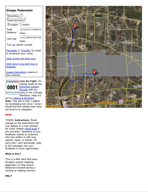
There’s a new Google Maps hack you might be interested in, it’s called Gmaps Pedometer, and it lets you double-click on a map to insert points and calculates the distance from the first throught the last point with (ridiculous) precision.
Here’s my bicycle commute to work, as an example.
The guy who made it is training for the Chicago Marathon and wanted a better way to calculate his running distances – it’s very well suited to uni-related stuff too.
Enjoy, and pass it along!
.max
I found my house, mwa ha ha ha. I’ve unicycled in that park to the north many a time.
It’s the one just to the left of house with the pool on Leyden.
I don’t get it. Google maps is still in Beta, and you can’t get to it from the frontpage of www.google.com. So why advertise it? People are going to go to google.com and complain that they can’t find the maps feature… It makes no sense to advertise something only people who know where to look can find.
Loose
Here’s a screen capture of the above tinyurl’d map, It takes a while to load google map stuff through a dialup, so this should be a bit quicker. I didn’t feel like refreshing the image to clean up the missing map tiles, but you get the idea.
The key point here is that I put in the route by hand and the nice api hack took care of the rest, including the distance. It’s also worth pointing out that since this is a google map, one can switch to zoomed-in satellite view to map courses which don’t show up as roads – about 90% of this marked route is not on a mapped road, and traced over a rails-to-trails multiuse path.
.max